
On a recent cold and wintry day, Ren and Scott of @xcountytravelers were en-route to conducting some business in Colorado (US). They passed along Colorado Hwy 69 between the small town of Westcliffe (estimated population of 628 in 2019 according to <a href="https://en.wikipedia.org/wiki/Westcliffe,_Colorado" target=Top)Wikipedia) and the community of Hillside. They found this lovely scene near the foot of Beddows Mountain.
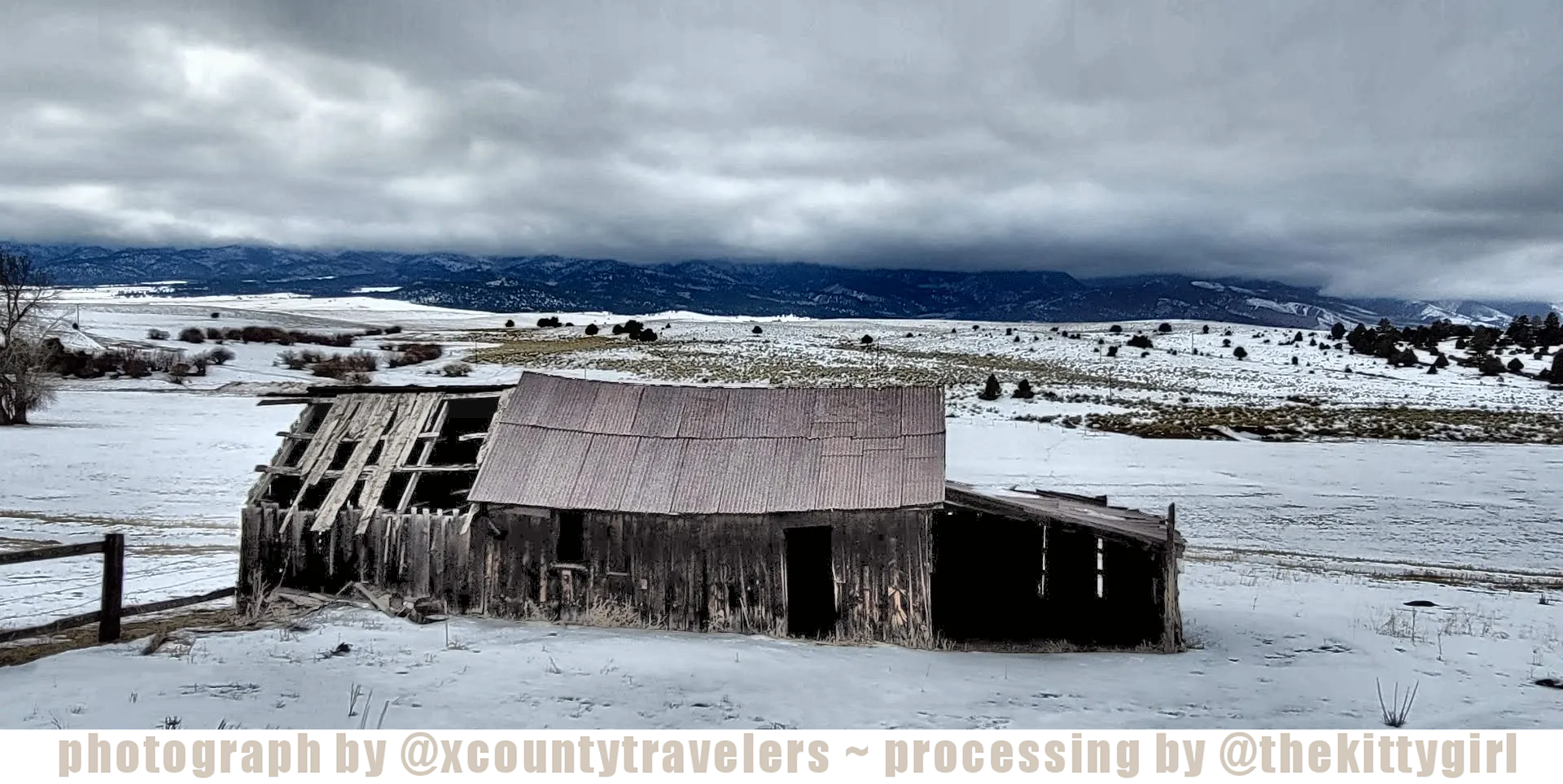
Since I like old barns, they paused to get this shot along the roadway for me. In doing so, they also captured a fabulous, picturesque, snowy landscape in the process. I was thrilled when Ren sent me this shot via Discord, and I appreciate their thinking of me when they are out-and-about! 😊
It's always sad to see a structure like this, which has obviously served its function well in the past, to fall into disrepair. The absence of a complete roof will only accelerate the deterioration of this building unless it is patched soon. This isn't the only barn on the property, though, and perhaps the other, larger barn is the one used the most now. With the current state of the world's economy, perhaps the owner doesn't have the funds or the motivation to keep up with repairs.
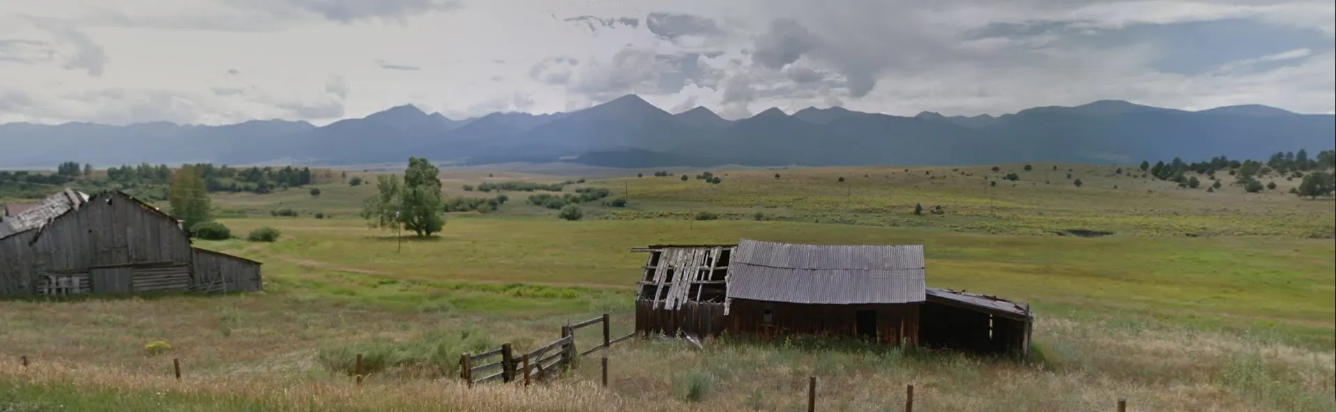
The larger barn on the property can be seen on the left-side of the following screenshot from BING Maps "Streetside View." Also, see the dark line across the horizon, just beneath the low-hanging clouds in the above photo? That is the base of the Rocky Mountains in the distance! On a clear day, they are quite visible from this spot as the following screenshot shows.
TIP: If you are using the PEAKD front-end/website for viewing the Hive blockchain, you can click the photos and zoom-in to get a better view! This feature is not available on Hive.Blog, sadly.
screenshot from BING Maps
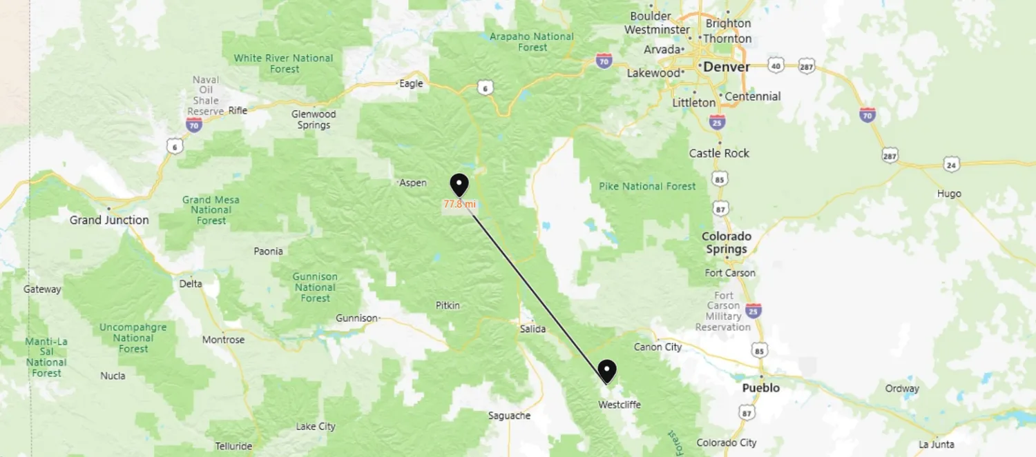
The following map shows the location of the barn in the valley above the town of Westcliffe, Colorado. The homestead on which the barn is located is private land, of course, but is immediately adjacent to the San Isabel National Forest. Not far from the homestead are some of the highest peaks in the Rocky Mountains, exceeding 14,000 feet (≈4300 metres) in elevation. The highest of all, Mount Elbert, stands at 14,440 ft (4400 metres) and is only 77.8 miles (125 km) away from the homestead. The homestead is marked at the lower (southeastern) terminus of the the line on the following map, while Mount Elbert is marked at the upper (northwestern) terminus.
screenshot from BING Maps
The following image is the original photo which @xcountytravelers sent to me. It is a good view of the barn except that the front of the barn is rather dark, not showing much detail.
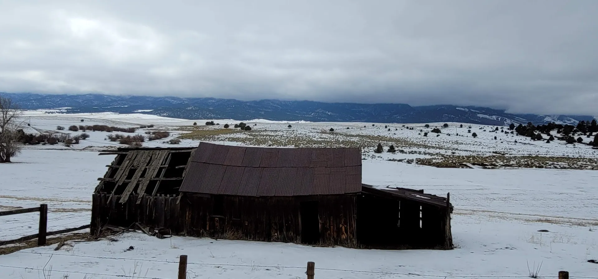
photo by @xcountytravelers
In the following edit, performed by me, I isolated the barn with a cropping tool and brightened it slightly, bringing out a tad more of the detail. I didn't want to go overboard with it, as I knew the further processing I planned would increase the brightness even more and didn't want the barn to be too washed-out with light. I also decided to remove the little bits of fence posts cluttering the bottom of the shot as well as the fence wire between them. It was from the below edit that I did the creative processing shown at the top of this article.
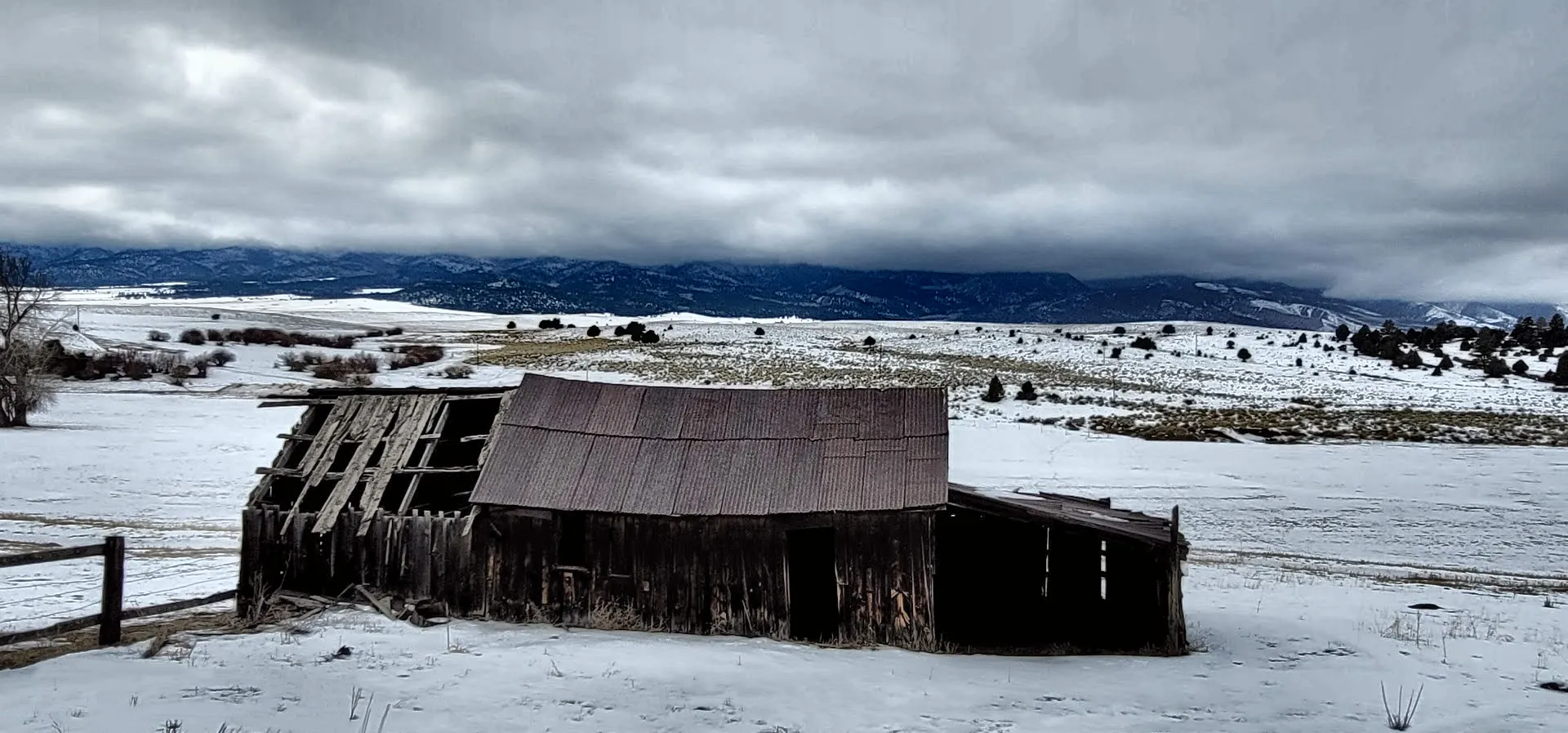
photo by @xcountytravelers · editing by @thekittygirl
As an appreciative gesture for sharing the photo with me along with permission to play with the processing and use it here, @xcountytravelers is named as 50% beneficiary on this post! Thank you, Ren & Scott, for sharing another shot from your fun travels!


21-Jan-2021
Return from Barn near Westcliffe, Colorado to 𝕜𝕚𝕥𝕥𝕪's Web3 Blog